


🎧
Listen to this article
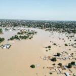
The Federal Government has issued an urgent warning that 915 communities spread across 19 states and the Federal Capital Territory face severe flood risks from August 27 to September 9, 2026, advising citizens in these danger zones to get ready for potential evacuations.
According to the National Flood Early Warning Systems Centre, these 915 locations fall into the critical risk category, demanding immediate monitoring and safety precautions.
In addition, 429 settlements across seven states were categorized under high risk, while 656 communities spanning 13 states were placed on a moderate-risk watchlist.
The 19 critical-risk states include Kogi, Benue, Rivers, Edo, Delta, Cross River, Bayelsa, Akwa Ibom, Abia, Anambra, Ebonyi, Enugu, Imo, Ekiti, Lagos, Ogun, Ondo, Osun, and Oyo.
Key urban centers listed in this bracket comprise Lokoja, Makurdi, Port Harcourt, Benin City, Asaba, Calabar, Yenagoa, Uyo, Aba, Onitsha, Enugu, Owerri, Lagos, Abeokuta, Akure, Osogbo, and Ibadan.
Authorities linked the heightened flood danger to heavy soil saturation, continuous rainfall, swift surface runoff, overflowing drainage networks, and rising water bodies.
Signed by Usman Abdullahi Bokani, the Director of the Erosion, Flood and Coastal Zone Management Department, the advisory mandates residents in critical areas to maintain strict watch and verify clear escape paths.
Citizens were cautioned to protect vulnerable family members and valuable items, and to completely avoid building, parking, trading, or storing goods inside floodplains, low-lying drainage paths, wetlands, and riverbanks.
Furthermore, state emergency agencies, environmental personnel, and local flood coordinators were directed to heighten surveillance around rivers, streams, bridges, culverts, gutters, reservoirs, and erosion-prone corridors.
For locations categorized under high risk—specifically Benue, Kogi, Kwara, Niger, Adamawa, Taraba, and Kebbi states—residents received instructions to step up gutter clearances and closely monitor water channels and culverts.
Meanwhile, the Federal Capital Territory alongside areas within Nasarawa, Plateau, Bauchi, Borno, Gombe, Yobe, Zamfara, Sokoto, Katsina, Kano, and Kaduna were marked as moderate-risk zones.
Officials warned that persistent rainfall could quickly accelerate flood levels in these moderate zones. Citizens were sternly instructed to obey official evacuation orders, keep children away from running water, and avoid driving or walking through flooded paths.
Families were additionally advised to cut off electricity supplies if inundation becomes imminent and to safely store essential medications, key documents, food supplies, and drinking water.
The administration emphasized that this alert should be interpreted alongside real-time local weather observations, water levels, and official directives.
Regular feedback from state governments, stakeholders, and community focal persons will also assist in field validations and ongoing updates to the national flood database.









No Comments